


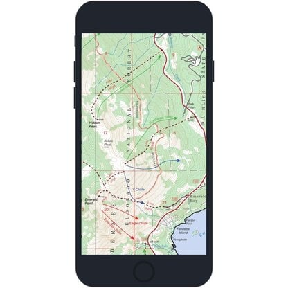
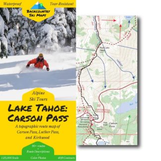
This easy-to-use map covers the Carson Pass area just South of Lake Tahoe, from Powderhouse Peak down to Round Top and Deadwood Peak, including the lift-accessed backcountry around Kirkwood (see below for a zoomable map with the full area of coverage).
Includes ski routes on:
- Round Top
- Powderhouse Peak
- Waterhouse Peak
- Melissa Coray Peak
- Fourth of July Peak
- Steven’s Peak
- Deadwood Peak
- and many more!
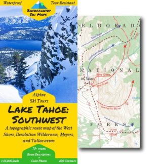
Route information, including suggested approaches and descents, is marked on a large scale 1:25,000 map, to help you make the most out of every day in the Carson Pass backcountry. The map is accompanied on the back by a self-contained field-guide which shows photos and gives detailed descriptions of some of the most worthy descents, making it easy to find the best trips for any conditions.
Descents of all varieties – from killer couloirs to wide open glades – are all covered, so that you can find the run that’s right for you, whether you’re a a hardened veteran or a beginner tourer.
Features:
- 90+ descents ranging from classics to rarely-skied lines
- Suggested ascent routes to get you up the hill as efficiently as possible
- Field-guide to the best descents complete with color photos
- Waterproof, tear-resistant so you never have to worry about damaging your map
- Fits in your pocket – the map folds down to 4.25″ x 9″
- Highly detailed with 40ft contour lines
- Easily readable with a 1:25,000 scale
** Please note that digital maps do NOT include the color photos or route descriptions included in the paper maps. You’ll need to download the Avenza app to use the digital versions of our Backcountry Ski Maps – they are not viewable on a PC or elsewhere outside of the Avenza app. **
Area of Coverage
David Conrad –
Honestly I’d love to see the addition of low-angle Nordic backcountry routes for the whole family to enjoy 🙂
saul –
I don’t go to this area very much, as North Lake is much closer to me. However, we recently took a trip to Kirkwood and there is so much great terrain in the Carson Pass area! We have used this map a little but plan on using it more in the spring. The combo of a digital map and a hard copy is hard to beat!
Jory –
Extremely useful backcountry tool.
Katherine Hill –
I ordered a digital copy. Not a copy to use in an app; I wanted a PDF digital version for reference for work. Totally wasted my money
Chris Noe –
I would give 5 stars if they were printed on heavier paper like a Harrison map
PATRICK –
Great information. Routes look good and match all visual research I’ve done. Can’t wait to see how it applies in the field with skins on.
Anonymous –
Just okay – could have managed without
Ryan Libbey –
Really wish the printed version incorporated a slopemap
William H. –
Very happy, great map
Peter Chatterton –
I wasn’t able to download to my Avenza app. So the portion of my cost paid to that service was wasted. Also, I was not aware when I purchased that the software was Avenza dependent, which I rarely use. As I result I was pretty disappointed overall.
I would be great if I could get downloaded simply on Gaia or that I could receive a refund for the non functional electronic portion
evanderkloot –
Hi Peter, I’m sorry to hear that you weren’t happy with your purchase. Unfortunately, as stated on each map’s page, the maps are “not viewable on a PC or elsewhere outside of the Avenza app.” It’s not possible to view them on Gaia. That being said, it sounds like you have the Avenza app but had trouble downloading your digital map. The maps will work on any device that supports Avenza, so if you contact our support team through our contact form, they’ll be able to help you get your download working!
Erin S. –
Super helpful
Allen I. –
These maps are one of a kind and an amazing resource. I highly recommend them.
James Kenny –
Love it, will be using it this weekend.
Bill M. –
These maps are awesome. The few routes that I’ve already done are described well and accurately mapped. I would like to see “slope angle shading” on the physical maps like the app shows. On the app, there’s no key so I can’t tell what slopes angles correspond to what colors. The app measurement tool is pretty bad.
David S. –
Great map
John C. –
Looks good, but don’t know this area as well.
Ken H. –
Would be 5 stars if they fixed one thing: roads need the stand out a little more and be labeled in such a way as to be readily identifiable. Why? Because, in many cases, the roads are the best reference point to get an idea of where on the map you are looking. Especially if you are unfamiliar with an area’s peaks.
Jessica S. –
Helpful route indicators, especially for the ascent
Charlie –
Not a fan how it doesn’t scale with the apps zooming. It’s a set number of pixels and detail and contour line separation, which is perfect for a map, when you have the whole thing in front of you, but not ideal when you have to zoom and scan to particular areas. Also it would be GREAT if your maps were compatable with Garmin or Gaia (preferably Garmin) so we could download them as an overlay on the watch or inreach and follow them from there. Currently, the one app that is available is really not a very powerful app and doesn’t have a lot of transferrable features to other apps (Garmin Basecamp, Strava, etc.). Would be most useful if the map either could overlay on these more popular apps, or if you could export gtx files of the routes after you purchase them.
This is a lot of personal preference, if I’m the only one, it’s not as big of a deal, but I do believe there’s a big opportunity here to expand/improve to make these maps even better than they are.
Craig –
Back country ski maps are awesome, won’t head out without the map on my phone. Trail routes can vary in the snow, I always know when I’m on or off route. Being able to look around and knowing where the established descents are is really helpful .
Anonymous –
Good stuff in this map!
Tristan –
Good bits without giving away the adventure
jamin horn –
Great maps, they pack a lot of useful information into a small space. Perfect to throw in the pack and get out with. Would definitely recommend to anyone looking to get out into the backcountry.
Anonymous –
A lot of new ideas
Peter W. –
I love the map. the purchase, download, install process was tedious
Anonymous –
useful and informative
Vince P. –
Incredibly helpful map! Really helps to be able to visualize general routes and areas rather than flipping through a book or searching web pages. Having a slope angles is very helpful too when deciding a route. And the ability to import the digital maps into Avenza is priceless (though I always carry the paper one with me too)! Will continue to buy these maps if more are released.
Linda D. –
Great map…just what I was looking for!
Anonymous –
I really like the slope shading on digital map. would like a little more detail on routes
Brandon G. –
Best digital map I’ve ever seen!
Greg J. –
Did great, good map for the collection. I like having paper maps in the pack when touring, “Just in case”, so this is an easy way to do it.
Ken G. –
Another comprehensive looking map. Kudos to whoever does the research for these. I love Carson Pass for early season skiing so I’m psyched to go ski some new stuff there!
mark cooper –
would love more details or a closeup of the kirkwood to backcountry access, its small on the map and the lifts and terrain is hard to see, also on some maps I see ski decent but not recommended approaches – like flag pole on the south tahoe map, other than that, they rock!
Mark C. –
Great job! I particularly appreciate the route description and photos on the back side of the map.
Andrew –
easy to understand, nice supplement to other resources
Stephen Rosenshein –
love it