

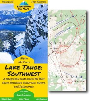
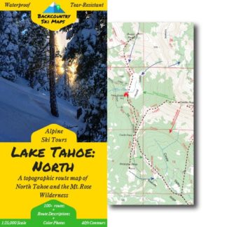
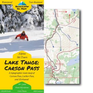
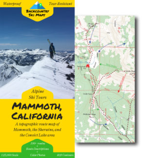
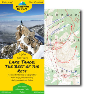
This comprehensive topographical route map makes it easy to find new ski lines in the Tahoe backcountry. Covering many of the areas that were left out of our paper map series, it includes some of the raddest descents around – from spine lines near Squaw to big open descents down into Carson Valley.
Peaks with descents on this map include:
- Twin Peaks
- Grouse Rock
- Trimmer Peak
- Freel Peak
- Job’s Peak
- Ellis Peak
- Stanford Rock
- and many more!
Route information, including suggested approaches and descents, is marked on a large scale 1:25,000 map to get you home safely.
Descents of all varieties – from killer couloirs to wide open glades – are all covered, so there is something for everyone from the hardened veteran to the beginner tourer.
Features:
- 70+ descents ranging from classics to rarely-skied lines
- Suggested ascent routes to get you up the hill as efficiently as possible
- Highly detailed with 40ft contour lines
- Easily readable with a 1:25,000 scale
** Please note that these digital maps do NOT include the color photos or route descriptions included in our paper maps. You’ll need to download the Avenza app to use the digital versions of our Backcountry Ski Maps – they are not viewable on a PC or elsewhere outside of the Avenza app. **
Kathy K. –
Great!
Katherine Hill –
I ordered a digital copy. Not a copy to use in an app; I wanted a PDF digital version for reference for work. Totally wasted my money
Jamin Horn –
Good deal, just wished there was a paper copy as well. Regardless they are still the same useful maps and the Avenza software they run in is pretty good!
Benjamin S. –
Super useful. Great tool for planning day in advance even finding your way on our tour.
Anonymous –
Maybe I am lazy, but I wish I could download the .gpx file for the different routes up. Or maybe I can, but haven’t spent the time to figure it out (I use GAIA when outdoors).
rini sugianto –
it’s awesome! the only thing that I found is missing , kinda like a big area map so i know which section it is in . For example. Just having something small that shows where the area location in the grand scheme of things of lake tahoe/reno etc
Alex Robinson –
Appreciate the trimmer peak map, that’s my backyard!
Ryan Libbey –
Really wish the printed version incorporated a slopemap
Ian Mclens –
Super informative and easy to use and navigate
Marc T. –
My only complaint about this series of maps is that the paper they are printed on is not durable enough. Get the paper to the same standard as the Tom hardy maps or the nat geo maps and I will know I can rely on them. The data in these map sets is awesome and the printed content on the physical maps is very valuable.
Allen I. –
These maps are one of a kind and an amazing resource. I highly recommend them.
Ken H. –
Would be 5 stars if they fixed one thing: roads need the stand out a little more and be labeled in such a way as to be readily identifiable. Why? Because, in many cases, the roads are the best reference point to get an idea of where on the map you are looking. Especially if you are unfamiliar with an area’s peaks.
rory s. –
Awesome maps of the Tahoe backcountry
Anonymous –
Thanks for the details! Would be nice to have some write ups too.